
What is a ‘fire cloud’, and how have they worsened wildfires in Europe?
As France and Spain battle some of the worst wildfires in recent history, experts have warned of an unprecedented phenomenon that could exacerbate the effects of the blazes: pyrocumulonimbus, or “fire...
As France and Spain battle some of the worst wildfires in recent history, experts have warned of an unprecedented phenomenon that could exacerbate the effects of the blazes: pyrocumulonimbus, or “fire clouds”.
Wildfires often spread when hot, windy and dry conditions coalesce but severe wildfires can generate their own unique weather systems. One of the most striking examples of this are pyrocumulonimbus clouds, or fire-generated thunderstorms, which are the most severe form of fire clouds.
Here is what you need to know about them.
What is a ‘fire cloud’?
In a nutshell, pyrocumulonimbus, or “pyroCb” clouds, are gigantic storm clouds that are generated by a wildfire.
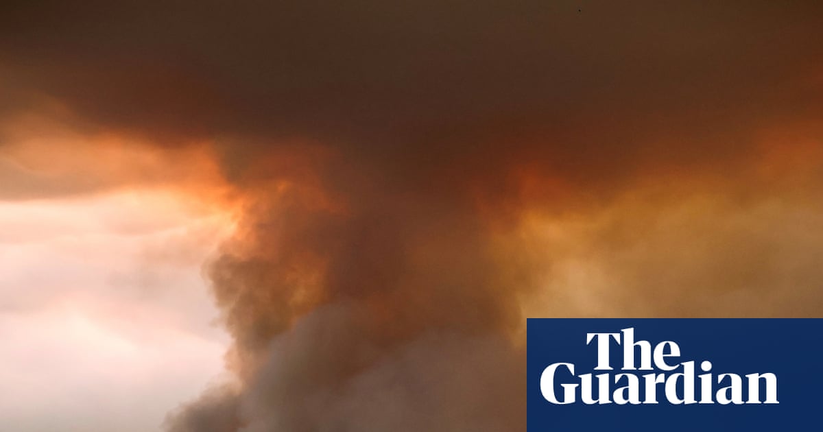
Massive wildfires emit large amounts of energy and heat that rapidly rise in a smoke plume. When the fire plume rises high enough, low atmospheric pressure causes its air to cool, and the moisture condenses and forms a cloud. Such clouds can generate lightning strikes and windy conditions.
If a wildfire is sufficiently large and intense, the smoke plume it generates can form a pyrocumulonimbus cloud, which can reach altitudes of 10–15km (six to nine miles) and penetrate the stratosphere. Nasa calls them the “fire-breathing dragon of clouds”.
“It’s a full thunderstorm forming within the fire plume,” says Rick McRae, an adjunct professor from the University of New South Wales’ (UNSW) bushfire research group. “These things, they get up to roughly 10,000 cubic kilometres of the atmosphere, so they have a big impact.”
Why are these pyrocumulonimbus cloud formations so dangerous?
When pyrocumulonimbus clouds form, they can create winds that make the wildfires below spread even faster, and sometimes generate their own lightning, which can in turn ignite more fires further afield.
Experts say stronger wind gusts can create more unpredictable fire patterns and therefore make conditions more dangerous for firefighters battling the blazes on the ground.
“The cloud is confirmation that the fire is very dangerous,” says UNSW’s McRae, who worked as a senior fire manager for 30 years. “The cloud is a confirmation that it’s appropriate that lots of people have been evacuated.”
How common are fire clouds?
Australia started experiencing pyrocumulonimbus clouds at the beginning of the century and experts say it appears they are becoming more common.
They also formed during massive wildfires in California in 2022, but this could be a new situation for France.
If confirmed, this would be the first time a pyroCb has been observed in France.
“It’s the first time France has had to explicitly consider the concept of a pyroCb,” says McRae. “Whether or not they had one a few days back or not isn’t really the question,” he says, “the question is whether there’s one coming on Tuesday, Wednesday this week.”
Why are these clouds occurring more frequently?
The climate crisis is creating more dangerous conditions for wildfires globally, and also the conditions that lead to the formation of pyrocumulonimbus clouds.
“It’s not just as simple as turning the temperature dial up. It’s full-on climate change,” says McRae. “It’s changes in the atmosphere, changes in the surface weather, changes in a lot of things.”
Experts say climate models indicate these trends will increase in severity in the future.
The wildfires in Europe have happened during peak tourist season in a region that has been hit by successive heatwaves, with woodland areas dried out from a lack of rain since May.
Weather forecasters warn another heatwave could hit France from Tuesday, with temperatures reaching 40C in some areas.
“There is going to be a blob of high heat that will move from Czechoslovakia over a four- or five-day period,” says McRae.