Greece is leading the world in wildfire detection thanks to EU-funded satellites and AI
As Greece braces for yet another exceptionally difficult wildfire season a new line of defence is being deployed from above. A specially designed fleet of satellites, each roughly the size of a small oven,...
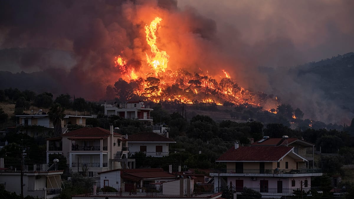
As Greece braces for yet another exceptionally difficult wildfire season a new line of defence is being deployed from above.
A specially designed fleet of satellites, each roughly the size of a small oven, will be on the lookout for the first signs of fire, creating a pioneering system that could save lives, protect communities and strengthen Europe’s push for technological autonomy.
Four OroraTech satellites, each smaller than a carry-on bag, were placed in low Earth orbit in May. Greece thus became the first country in the world to deploy a satellite constellation dedicated specifically to firefighting.
Instant real-time updates in the field, powered by Artificial Intelligence
The satellites carry thermal sensors designed to spot new fire outbreaks as small as four metres across, surpassing the capabilities of conventional satellites, which can only detect fires comparable in size to a cruise ship.
“We scan an area, use these images and send them to our artificial intelligence models. They analyse them with precision down to grid cells of 4 by 4 metres. Then, based on that analysis and the data held by the AI models, they can determine whether it is a fire or not. We then take this information and pass it on to the fire service or any other authority connected to the system,” explains OroraTech’s CEO, Ioannis Landouris.
When a fire breaks out, incident commanders will receive an immediate alert with the location, size and intensity of the blaze already calculated. When several fires are burning at the same time, real-time data becomes crucial for making decisions on the response and the deployment of resources.
“The platform brings together all the data and presents it to you as you are, for example, trying to put out a fire. So if you are in the field with your tablet, you can see that: ‘If I deploy my crews here and here, there is a higher risk that the fire will move in that direction.’ At the same time, you can run simulations and forecast how the fire is likely to develop and spread,” Ioannis Landouris points out.
Papastergiou: 'Support in critical periods'
“These satellites will help us in critical periods, such as the summer in Greece, when unfortunately we often face large wildfires. A fire in an urban environment is easily noticed by residents; they see the smoke and alert the authorities. However, a fire in a national park or a remote area can be detected much more quickly by such a satellite, which, thanks to its thermal cameras, can pick up these hot spots,” says Greece’s Minister of Digital Governance, Dimitris Papastergiou.
Life-saving support for firefighting crews
The thermal sensors also detect solar panels, overheated factory roofs and rock surfaces warmed by the sun, but artificial intelligence models have been designed to filter out these false signals before alerts reach the emergency services.
“With the four nanosatellites OroraTech launched in May, we will have this type of information every hour. There will be no gaps in coverage. This is important not only for early detection but also for the models that predict how a wildfire will spread. In this way, we will know every hour how the fire is developing and moving,” stresses Fire Brigade Commander Zisoula Dasiou.
The total cost of the network comes to €200 million and is funded by the European Union. Falling launch and manufacturing costs have made this expansion possible. The Greek programme is expected to be completed by the end of the year.